Hukou Geopark
Hukou Geopark
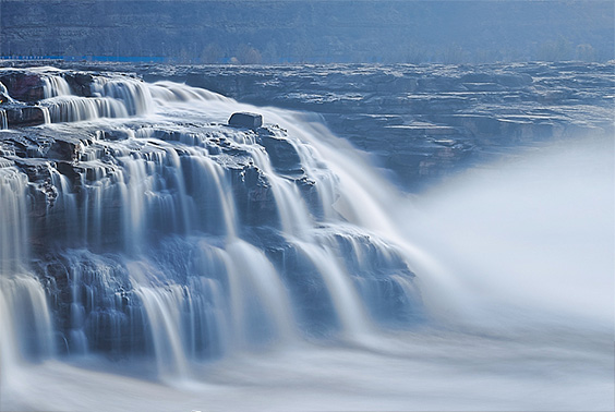
Hukou Geopark is centered on Hukou Waterfall and is built on the east and west banks of the Yellow River. The park consists of Hukou Waterfall Tourism Area, Kenan Slope Tourism Area, Zhongshi Tourism Area and Xiaochuanwo Tourism Area, with a total area of about 45.5 square kilometers. The geopark is located in Ji County, southwest of Shanxi Province, in the middle reaches of the Yellow River. The park is located on the eastern side of the Ordos platform syncline. It is in the north-south structure of the Yellow River. The park is dominated by the Triassic Ermaying Formation strata, with a gentle ground pattern and relatively simply structural comparison. National highways 209 and 309 run through them, and some sections have expressways. The traffic conditions are very convenient. It belongs to the monsoon climate of medium latitudes, with an average annual temperature of 10℃ and a precipitation of 580mm. The precipitation in July, August and September accounts for 70% of the year. The Yellow River runs through Jixian County for 56.5km. The amount of flow in May and June is 250m3—300 m3 per second. The amount of flow in July, August and September are 250 m3 per second. The amount of flow in winter is 300 m3 to 500 m3 per second. The maximum flow rate is 22,500 m3 per second and the minimum flow rate is 130m3 per second.

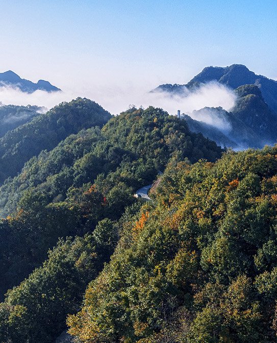
The Hukou Waterfall Tourism Area belongs to the geopark. It is centered on the Hukou Waterfall. The area of the scenic area is 3.5 square kilometers. The main geological relics in the tourism area include the main waterfall of Hukou Waterfall, the auxiliary waterfall on both sides, "Shili Dragon Trough", "Stone Nest and Treasure Mirror", "underground waterfall viewing gallery", "checkerboard structure", "erosion trough", etc. The cultural and historical landscapes include the Ming-Qing Dynasty Wharf, the Great Wall of Qing Dynasty, and the Ox and Horse King Temple. Kenan Slope Tourisn Area is located at the northernmost end of the geopark, covering an area of about 7 square kilometers. The geological relics are geological landscapes dominated by loess landforms, mainly including the fourth-level terraces of the Yellow River. It was once an important military and political site. During the Anti-Japanese War, it was the headquarters of the Second World War Area of the National Revolutionary Army and the location of the Shanxi Provincial government. Adjacent to the Hukou Waterfall Tourism Area is the Zhongshi Tourism Area, covering an area of about 22 square kilometers. The main landscape is the loess landform. The southernmost point of the geopark is the small boat nest tourism area, with a total area of about 13 square kilometers, dominated by river erosion geological sites.