Reasons for the emergence of Hukou Waterfall (Explanation 2)
- Geological changes
- Source:Geological changes
- Browse volume:
- Release time:2021/10/27
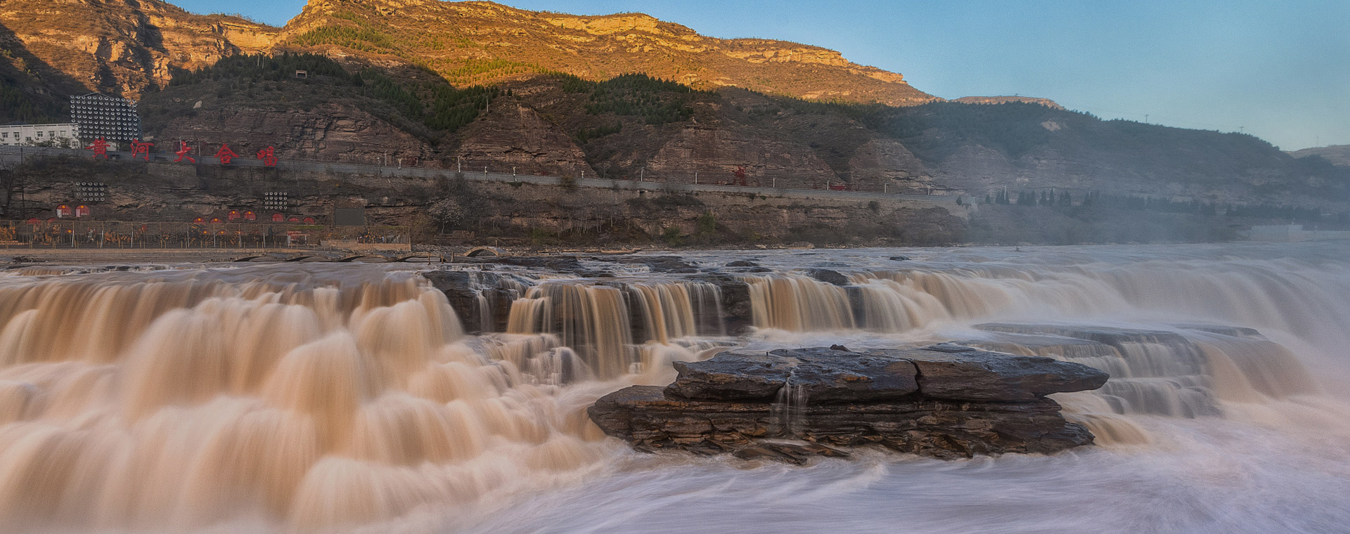
The emergence of Hukou Waterfall is due to several natural geographical factors,such as the local geological structure, geomorphology, climate, hydrology, etc.
The bedrock in the Hukou area is mainly the Triassic period of Zhifang Formation. The upper part is interbedded with purple-red, purple-grey and gray-green fine sandstone and argillaceous rock, and the lower part is deep sandstone, which is mainly feldspar sandstone with relatively hard texture; the argillaceous rock is mainly shale, which is soft, fractured and easily corroded by running water. In the steep canyon, the rushing jet stream encounters the geological conditions of alternating soft and hard rocks when it cuts vertically. Its hard rocks form rock thresholds or waterfall formations, and soft rocks are eroded into steep steps,over which the jet stream fly. When there is a certain drop, a waterfall is emerged. One thing for sure, the soft and hard rock layers are only the favorable stratum conditions for the emergence of waterfalls.
Favorable structural conditions are also important for the emergence and development of Hukou Waterfall. From Hukou to Mengmen, the occurrence of bedrock is close to horizontal, with an inclination angle of about 3-5 degrees, slightly inclined to the northwest.Besides, the Shanxi-Shannxi Gorge itself is a fault,where the joint development is relatively weak and is vulnerable to erosion and cutting by running water. Therefore, when the Yellow River passes by, steep ridges on the riverbed are often formed, and waterfalls can also be developed. Now tectonic movement also has an important influence on the emergence and development of Hukou Waterfall. After the Himalayan movement, the crustal movement here has been dominated by slow uplifting, so the downward cutting effect of the current is active, which triggers the emergence and development of the waterfall.
Before the Yellow River formed a unified water system. The main area of Shanxi-Shannxi Gorge is an inland river that inflow into Sanmen Lake. During the formation process of the Fenwei graben, due to the decline in the differences in different sections and different time periods, a series of lakes of different sizes and depth which separated from each other were formed, such as the mainly lakes and swamps environment in Linfen, Yuncheng and Guanzhong areas,etc from the Tertiary to the beginning of the Quaternary. Especially at the end of the Pliocene, as the Fenwei graben tension emerged, the size of the lake became increasingly large. In the early Pleistocene, Sanmen Lake with an area of about 23,000 square kilometers emerged at the junction of the today’s three provinces of Shaanxi, Shanxi and Henan, including where Guanzhong area of Shaanxi Province, the southwest of Shanxi Province and the west of Henan Province.This ancient lake is the predecessor of the current Guanzhong, Linfen-Yuncheng, Lingbao-Sanmenxia basins. The settlement of the Sanmen Lake area and the uplift of the surrounding area accelerated the deepening and extension of the Qin-Jin ancient river channel.
The Shanxi-Shannxi Gorge and Hukou Waterfall have gradually emerged on the basis of such ancient landforms. The emergence and development of Hukou Waterfall is due to the development and movement of knick point on the river bed, which are the steep slopes suddenly formed in the river. The most typical knick point is the waterfall. Because the waterfall is the place where the river water falls vertically, the "waterfall making layer" formed by a layer of hard rock ensures that the waterfall will not be eroded by the river water but turn into a rapid stream. Below the waterfall is a deep pool formed by the impact of the waterfall. If the waterfall making layer is eroded and receded, then a short gorge will be formed in front of the waterfall as the waterfall moves back constantly. The landscape of Hukou Waterfall is exactly like this. Mengmen was once where Hukou Waterfall was located in the past. Due to the erosion of the source, the knick point continued to move upstream along the river, and the deep pool under the waterfall became a small channel in the river channel, that is, today's "Shili Dragon Trough". Now the knick point in this section of the Yellow River has reached Longwangyuan, which is today's Hukou Waterfall. And Mengmen is the two stone islands that were left in the middle of the river when the knick point retreated and the river was cut down in the recent geological period.
Hukou Waterfall is in the warm temperate zone with humid, semi-humid and semi-arid climate. The heavy rain in the Shanxi-Shannxi Gorge Basin has a large area of precipitation with a long duration and high rainfall intensity. The maximum daily rainfall can reach 200-300 mm, which is one of the main sources of floods in the middle reaches of the Yellow River. The floods in the middle reaches of the Yellow River are featured with high peaks, short duration, and tall and thin process lines. Because this area is mainly a loess hilly and gully area with a large undulating surface and short period of water collection. After the heavy rain, mud and sand flow together into the Yellow River, thereby forming a torrent with high sand content, which has a strong erosivity to the river bed. Our observation shows that the maximum flow of Hukou Waterfall during the flood period can reach 10,500 cubic meters per second. In addition, between Hekou Town and Longmen District, the annual average amount of sediment entering the Yellow River is 908 million tons, accounting for 55.7% of the total annual sediment transport of the Yellow River.Such climatic and hydrological characteristics are favorable to the emergence and development of Hukou Waterfall.

